Guests at our cabins can access Yonah Mountain Trail using our “Private Access” to the trail head, directly from our cabins!
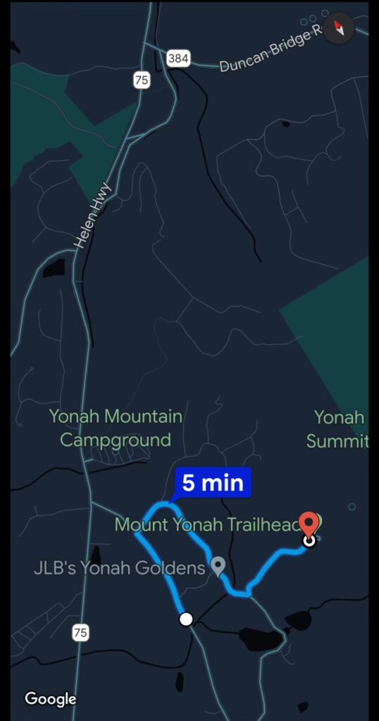
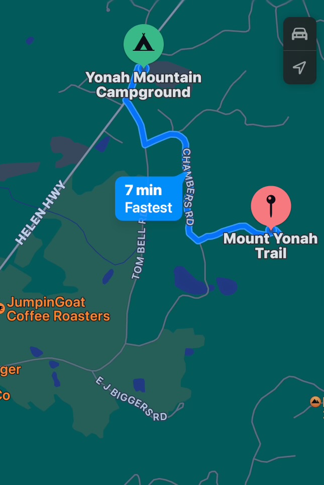
Guests at our Cabins can access The Yonah Mountain Trail and HIKE to the the summit of Yonah Mountain, by walking back down Bald Eagle Path and then turning left onto Yonah Mountain Road, which will take you to the beginning of the trail. After about 30 minutes you will arrive at a 5 bar gate, this is the beginning of Yonah Mountain Trail. Please do NOT take a vehicle up Yonah Mountain Road as there is NO parking at the start of the trail. If you wish to take a car, the TRAIL you can reach the PUBLIC access point via Chambers Road. It is a really fantastic HIKE, with wonderful views when you reach the top of the mountain.

Yonah Mountain Trail Introduction
From the Public access parking lot off Tom Bell Road and Chambers Road
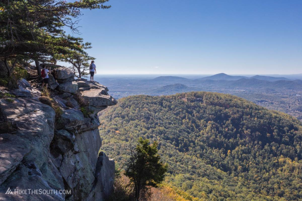
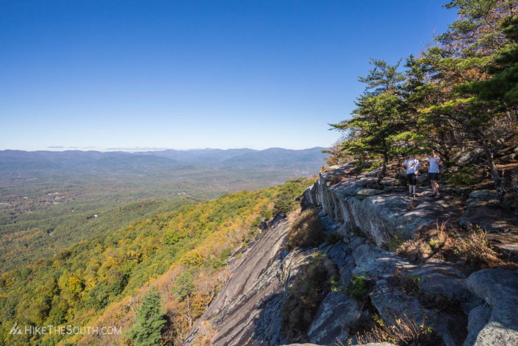
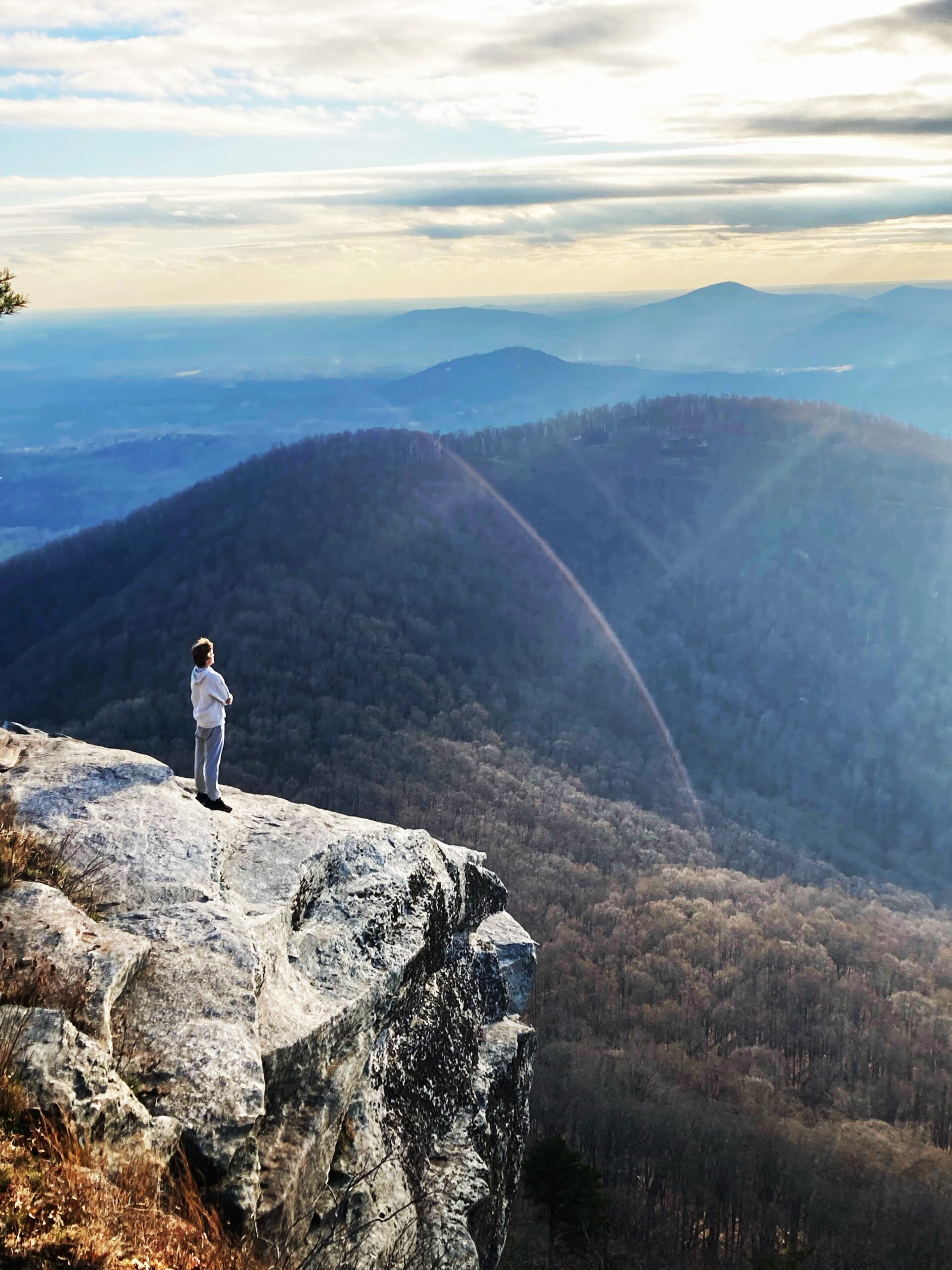
One of north Georgia’s most popular hikes for good reason, Yonah Mountain offers breathtaking views from the south to the northwest all along its lengthy bare rock face. The scenery is even more rewarding due to the steep climb of 1500 feet in just over 2 miles. Although this trail is definitely not for beginners, it’s one that should be on every hiker’s bucket list.
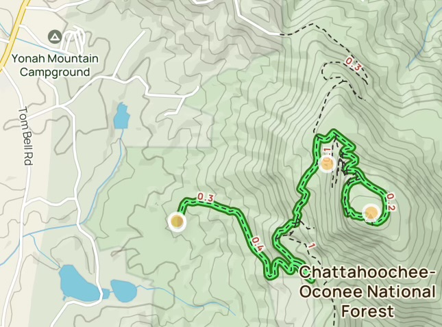
A short but bumpy dirt road leads to the large parking area where the summit of Yonah Mountain looms above the trees directly in front of you. Two trails leave the parking lot on the left and quickly join together, so take either one.
The GOOD NEWS IS, THAT IF YOU ARE STAYING IN ONE OF OUR CABINS ON YONAH MOUNTAIN, YOU CAN USE OUR PRIVATE ACCESS UP TO THE TRAILHEAD VIA YONAH MOUNTAIN ROAD
(You will be provided directions to the Yonah Mountain Trail Head, via our private access from our cabins, when you confirm your reservation)
Green blazes mark the trail and are present at most intersections, but not all, so make sure to check out the navigation below.
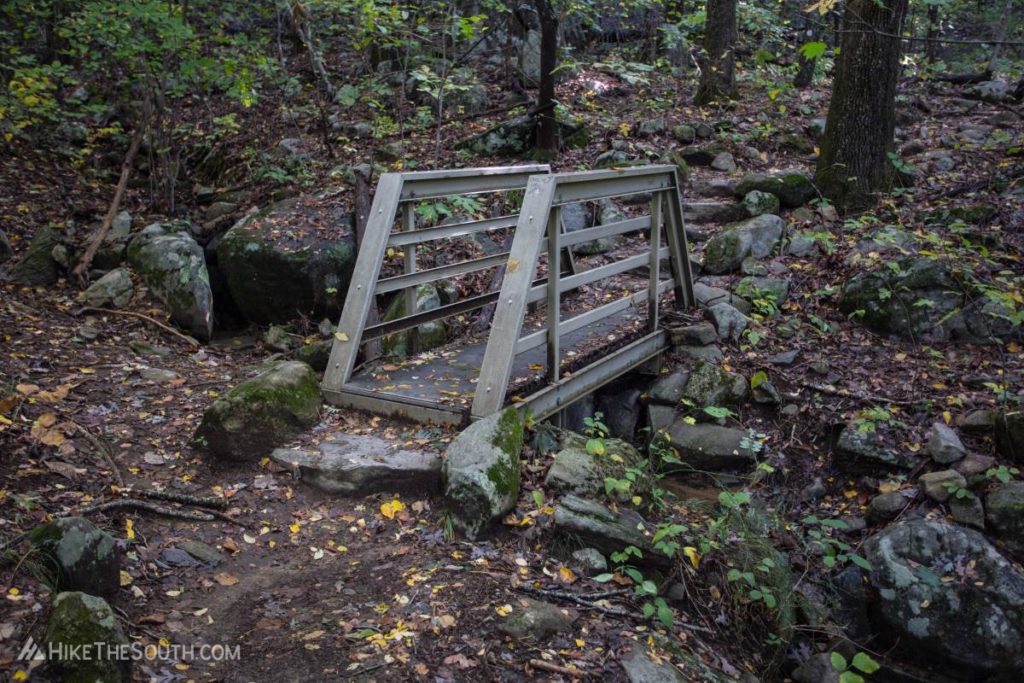
The trail begins ascending immediately and other than a couple short sections, doesn’t let up until reaching your destination. At first, enjoy a more moderate rate of 600 feet per mile. Hike across a small footbridge as you hug the contours of the mountain, navigating through small boulder fields and up stone staircases.
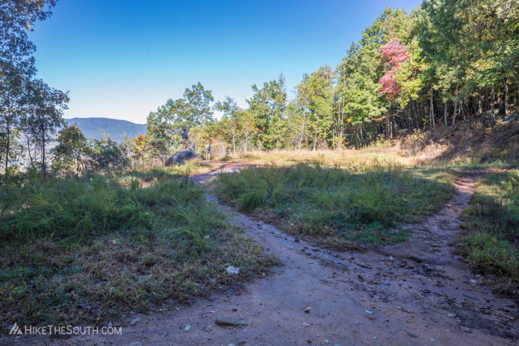
At the halfway point you’ll reach a small field on the left. Standing atop a large boulder you get a preview of what’s to come. A few side trails lead away from the field but fade out quickly. The main trail continues along the right side of the field, following the blazes. You’ll start to ascend an extremely rocky ditch. You can go up it but look for the friendlier trail up above to the left. Either way you’ll be climbing over 1600 feet per mile for the next 400 feet before continuing the rest of the way at around 750 feet per mile.
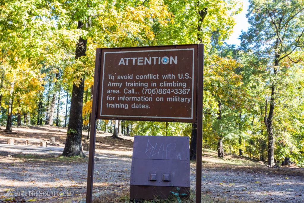
At 1.5 miles turn right on the wide gravel road, continuing uphill. Make sure not to miss this turn on the way back down. Just after you’ll reach the US Army training area. The gravel road continues to the right, with another trail splitting off even further right.
The simplest directions are to stay on the wider gravel path all the way up, but you can take this other trail straight up the hill making for a more difficult, but slightly shorter route.
These two trails reconnect at a 5-way split with the gravel road turning back to the left. Again you can take a trail straight up the mountain just as before. Also straight in front of you is another trail that leads toward the base of the rock face so ignore this one. Again the two trails connect with the gravel road again turning sharply back to the left. At this intersection is a short side trail to a view as well.
At 1.9 miles the trail opens to a steep bare rock clearing. Continue along the bottom and the trail splits just after forming the loop around the summit. Turn right to head straight to the majority of the views along the main rock face of Yonah Mountain. Continuing straight takes you to the open grassy field at the summit. A short side trail on the left leads to a view and a network of smaller trails connect the two sides and lead to further views.
Explore around for amazing view after amazing view but always be careful. All of these open views are due to the near vertical drops.
Unfortunately, people do occasionally fall and get seriously injured or worse, so just pay attention and keep your distance if the rock is wet or icy. On your way back down make sure to take it slow down the steep slopes, loose rocks are just begging for an ankle to roll.
